A magnitude 7.3 earthquake occurred on the 12th November 2017 at 18:18 UTC in the northwest of Iran at a depth of about 23 km. The epicentre location is close to the border with Iraq, 209 km northeast of Baghdad. At least 330 fatalities have been reported to date and thousands of people have been injured. The earthquake rupture is related to plate convergence between the Arabia and the Eurasia plate and strong damaging earthquakes in the region are not uncommon. The most damaging event in recent times was a magnitude 7.4 earthquake in June 1990 in the Rasht-Qazvin-Zanjan area. That event caused 40,000 to 50,000 fatalities and left over 600,000 people homeless.

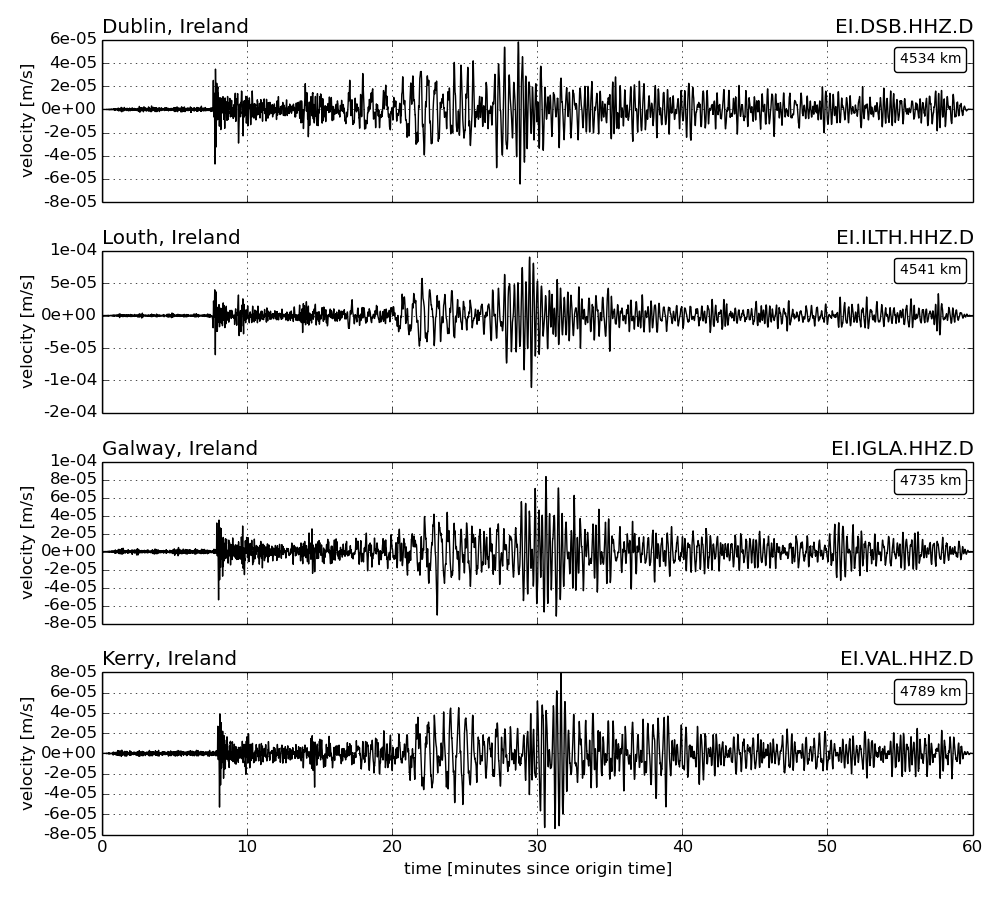
The 12th November 2017 earthquake was recorded at seismic stations worldwide, including stations of the Irish National Seismic Network (INSN), see seismic waveforms below (select figure to enlarge).
Further information is available from the following webpages:
- EMSC: https://www.emsc-csem.org/Earthquake/earthquake.php?id=629693
- GFZ:Â http://geofon.gfz-potsdam.de/eqinfo/special/gfz2017wexs
- USGS:Â https://earthquake.usgs.gov/earthquakes/eventpage/us2000bmcg#executive
More information about the INSN is available via this link.


