A strong earthquake of magnitude 7.6 occurred on the 10th January 2018 at 02:51:32.1 UTC in the Caribbean Sea, about 200km from the northern coast of Honduras, see map below. A tsunami alert was first issued but has been lifted since. The event is due to movement on the North America-Caribbean plate boundary and was felt in Honduras, Guatemala, Costa Rica, El Salvador and some parts of Mexico. There are no reports of injuries or structural damage. 
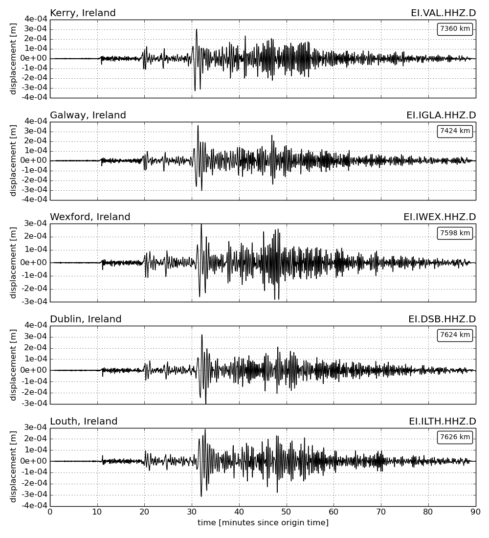
The earthquake was recorded at seismic stations worldwide, including stations of the Irish National Seismic Network (INSN), see seismic waveforms below (select figure to enlarge).
Further information is available from the following webpages:
EMSC:Â https://www.emsc-csem.org/Earthquake/earthquake.php?id=640330
GFZ:Â https://geofon.gfz-potsdam.de/eqinfo/event.php?id=gfz2018aqre
USGS:Â https://earthquake.usgs.gov/earthquakes/eventpage/us1000c2zy#executive
More information about the INSN is available via this link.


