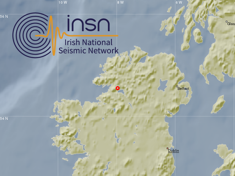
On the 29th April 2019 at 21:18:23 local time (20:18:23 GMT) an earthquake of magnitude 2.1 occurred in Donegal. The location of the epicentre is 54.56N, 7.96W, about 15km south-east from Donegal town and 15km north-east from Ballyshannon, see figure below. The earthquake was detected automatically by the Irish National Seismic Network (INSN) which is operated by the Dublin Institute for Advanced Studies (DIAS) in co-operation with the Geological Survey Ireland (GSI). The event was felt by members of the public in the south of Co. Donegal and parts of Co. Fermanagh and Co. Leitrim, see map at the bottom of this post. If you felt or heard this event please consider clicking here to fill out a small report. Short interviews about the earthquake were given by Dr Martin Möllhoff, Director of Seismic Networks at DIAS, in this ‘News at One’ bulletin on Radio RTE 1 and on OceanFM.
The event was recorded on the stations of the Irish National Seismic Network (INSN), see seismic traces below. Some stations from the BGS network in the UK detected the event as well.


